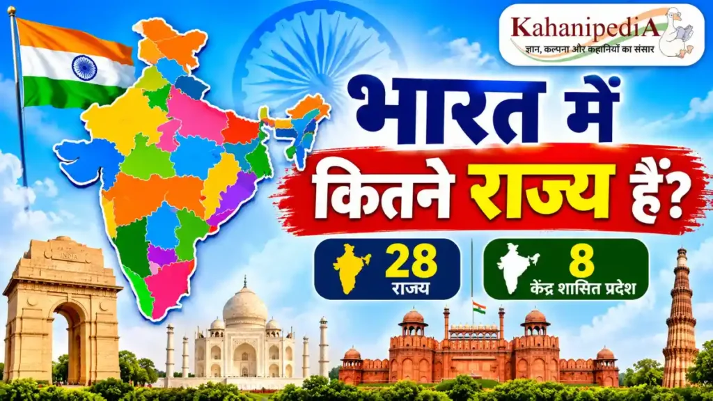
India is one of the largest and most diverse countries in the world. It is known for its different cultures, languages, traditions, geographical landscapes and historical places. For administrative purposes, India is divided into states and Union Territories. If you are searching for bharat mein kitne rajya hain (How many states are there in India), the country currently has 28 states and 8 Union Territories.
Each state has its own government, administrative system, culture and capital city. Union Territories, on the other hand, are administered by the Central Government, although some of them have their own elected governments.
In this article, we will explore how many states are there in India, the complete list of 28 states and their capitals, all 8 Union Territories, the difference between states and Union Territories, and some interesting facts about India.
How Many States Are There in India? (भारत में कितने राज्य हैं?)
India has 28 states and 8 Union Territories.
India is officially known as the Republic of India. The country is divided into 28 states and 8 Union Territories to make administration, governance and development easier. Every state has its own capital, and most states have an elected state government headed by a Chief Minister.
The Union Territories are governed by the Central Government, although certain Union Territories, such as Delhi, Jammu and Kashmir, and Puducherry, have legislative assemblies and elected governments with powers defined by law.
Here is a quick overview of the states and Union Territories of India:
| Particulars | Details |
|---|---|
| Total States | 28 |
| Total Union Territories | 8 |
| Total State and UT Units | 36 |
| Capital of India | New Delhi |
| Country | Republic of India |
| Independence Day | 15 August 1947 |
| Republic Day | 26 January 1950 |
List of 28 States and Capitals of India (Indian States and Capitals)
India has 28 states, and each state has its own capital, which serves as an important centre for administration and government activities. Below is the complete list of Indian states and their capitals in alphabetical order.
| No. | State | Capital |
|---|---|---|
| 1 | Andhra Pradesh | Amaravati |
| 2 | Arunachal Pradesh | Itanagar |
| 3 | Assam | Dispur |
| 4 | Bihar | Patna |
| 5 | Chhattisgarh | Raipur |
| 6 | Goa | Panaji |
| 7 | Gujarat | Gandhinagar |
| 8 | Haryana | Chandigarh |
| 9 | Himachal Pradesh | Shimla |
| 10 | Jharkhand | Ranchi |
| 11 | Karnataka | Bengaluru |
| 12 | Kerala | Thiruvananthapuram |
| 13 | Madhya Pradesh | Bhopal |
| 14 | Maharashtra | Mumbai |
| 15 | Manipur | Imphal |
| 16 | Meghalaya | Shillong |
| 17 | Mizoram | Aizawl |
| 18 | Nagaland | Kohima |
| 19 | Odisha | Bhubaneswar |
| 20 | Punjab | Chandigarh |
| 21 | Rajasthan | Jaipur |
| 22 | Sikkim | Gangtok |
| 23 | Tamil Nadu | Chennai |
| 24 | Telangana | Hyderabad |
| 25 | Tripura | Agartala |
| 26 | Uttar Pradesh | Lucknow |
| 27 | Uttarakhand | Dehradun |
| 28 | West Bengal | Kolkata |
Note: Some states have additional seasonal or secondary administrative centres. For example, Uttarakhand uses Gairsain (Bhararisain) as its summer capital, while Dehradun is its winter capital. The table lists the commonly recognised primary capital names for general reference.
List of 8 Union Territories of India and Their Capitals
India has 8 Union Territories (UTs). Unlike states, Union Territories are administered by the Central Government. However, some Union Territories have their own elected legislatures and governments.
Below is the complete list of all 8 Union Territories of India and their capitals.
| No. | Union Territory | Capital |
|---|---|---|
| 1 | Andaman and Nicobar Islands | Sri Vijaya Puram (formerly Port Blair) |
| 2 | Chandigarh | Chandigarh |
| 3 | Dadra and Nagar Haveli and Daman and Diu | Daman |
| 4 | Delhi (National Capital Territory) | New Delhi |
| 5 | Jammu and Kashmir | Srinagar (Summer), Jammu (Winter) |
| 6 | Ladakh | Leh |
| 7 | Lakshadweep | Kavaratti |
| 8 | Puducherry | Puducherry |
Why Does India Have 28 States and 8 Union Territories?
India has a large geographical area and a population with different languages, cultures, religions and traditions. To manage the country effectively, its administrative structure is divided into states and Union Territories.
States have their own elected governments and work under the constitutional framework of India. Union Territories are generally administered by the Central Government through administrators or Lieutenant Governors.
The number of states and Union Territories in India has changed several times since independence. These changes have been made to improve administration, accommodate regional demands and reorganise territories.
How Did the Number of Indian States Change Over Time?
After India gained independence in 1947, the country had several provinces and princely states. Integrating these territories into one nation was a major task. Sardar Vallabhbhai Patel played a significant role in the integration of princely states.
Over the following decades, India’s administrative boundaries changed several times. States were reorganised to improve administration and accommodate linguistic and regional identities.
Some major changes in the number of states and Union Territories are explained below:
- 1956 – States Reorganisation: The States Reorganisation Act, 1956, reorganised state boundaries largely on linguistic grounds and significantly reshaped India’s administrative map.
- 2000 – Three New States: Chhattisgarh was created from Madhya Pradesh, Jharkhand from Bihar and Uttarakhand from Uttar Pradesh.
- 2014 – Telangana: Telangana was formed from the former state of Andhra Pradesh on 2 June 2014. It became India’s 29th state at that time.
- 2019 – Jammu and Kashmir Reorganisation: The former state of Jammu and Kashmir was reorganised into two Union Territories, Jammu and Kashmir and Ladakh, effective 31 October 2019.
- 2020 – Union Territory Merger: Dadra and Nagar Haveli and Daman and Diu were merged into one Union Territory on 26 January 2020.
These administrative changes helped shape the present structure of 28 states and 8 Union Territories.
Capital of India and Its History (New Delhi)
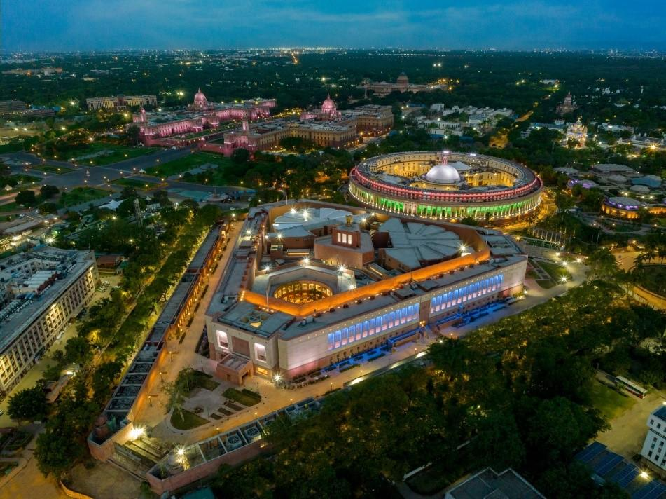
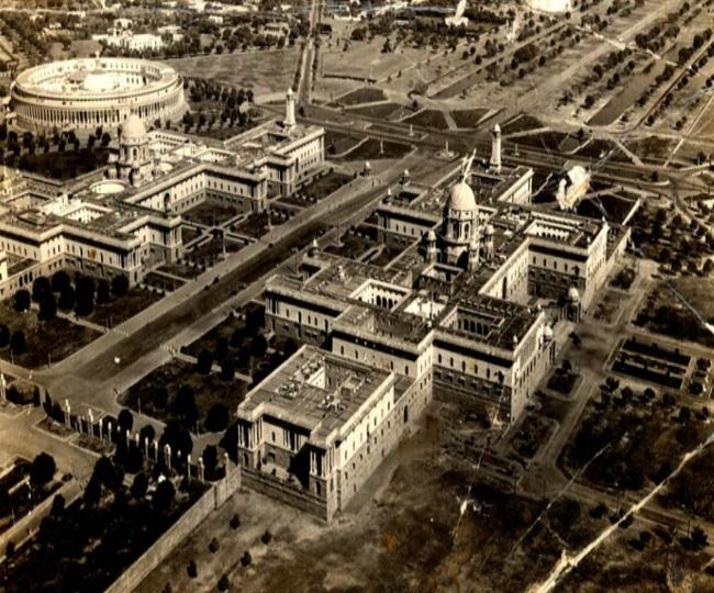
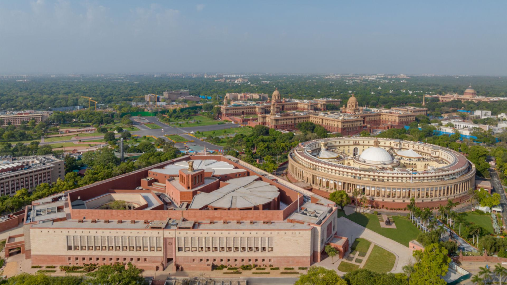
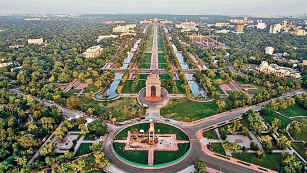
New Delhi is the capital of India. It is located in the northern part of the country and serves as the country’s political, administrative and governmental centre. Important institutions, including Parliament, the Supreme Court, Rashtrapati Bhavan and several ministries, are located in New Delhi.
Before New Delhi became the capital, Kolkata (formerly Calcutta) served as the capital of British India. In 1911, during the Delhi Durbar, King George V announced the decision to shift the capital from Calcutta to Delhi.
The planning and architecture of New Delhi were largely carried out by British architects Edwin Lutyens and Herbert Baker. The city was officially inaugurated as the capital on 13 February 1931 by the then Viceroy of India, Lord Irwin.
After India gained independence on 15 August 1947, New Delhi continued to serve as the capital of the country and remains the centre of India’s national government.
Political Map of India – States and Capitals
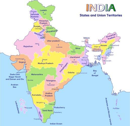
A political map of India shows the boundaries of the states and Union Territories, along with their locations and capitals. It is useful for understanding India’s geographical divisions and identifying the different regions of the country.
Students often use political maps to learn the names of states, capitals, Union Territories, neighbouring states and major geographical locations. It is also helpful for general knowledge, school examinations and competitive exams.
Difference Between States and Union Territories of India
States and Union Territories are both administrative units of India, but they differ in their governance, powers and relationship with the Central Government.
| States of India | Union Territories of India |
|---|---|
| States have their own elected state governments. | Union Territories are generally administered by the Central Government. |
| State governments operate under the constitutional framework and state legislative powers. | Administration is generally handled by a Lieutenant Governor or Administrator appointed by the President. |
| A Chief Minister heads the elected state government. | A Lieutenant Governor or Administrator generally represents the Central Government. |
| States have their own constitutional and legislative responsibilities. | Union Territories have powers defined by constitutional provisions and applicable laws. |
| States have a federal relationship with the Central Government. | Union Territories have a more direct administrative relationship with the Central Government. |
| States have elected legislatures. | Some Union Territories have elected legislatures, while others do not. |
General Information About India (Interesting Facts)
India is a country with a rich history, diverse culture and unique geographical features. Here are some interesting facts about India that are useful for students and general knowledge readers.
- Official Name: Republic of India.
- Capital: New Delhi.
- Total States: 28.
- Total Union Territories: 8.
- Independence Day: 15 August 1947.
- Republic Day: 26 January.
- National Currency: Indian Rupee (INR).
- Official language of the Union: Hindi in Devanagari script; English continues to be used for official purposes under the Official Languages Act.
- Geographical Location: India is situated in South Asia.
- Neighbouring Countries: Pakistan, China, Nepal, Bhutan, Bangladesh and Myanmar, among others in the wider regional context.
- Largest State by Area: Rajasthan.
- Smallest State by Area: Goa.
Frequently Asked Questions (FAQs) About States and Capitals of India
India has 28 states. Each state has its own administration, capital and government. The states are responsible for several regional administrative functions under the Constitution of India.
India has 8 Union Territories. These are administered by the Central Government, although some have their own elected legislatures.
New Delhi is the capital of India. It is the centre of the country’s government and houses important national institutions, including Parliament and the Supreme Court.
Rajasthan is the largest state in India by area. It is known for its deserts, forts, historical places and rich cultural heritage.
Goa is the smallest state in India by area. It is popular for its beaches, tourism, historical churches and Portuguese-influenced architecture.